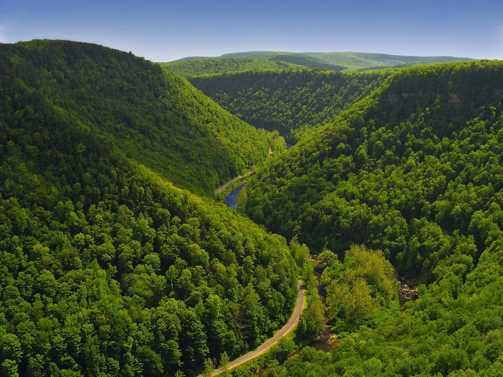
Long-distance hikers have a nickname for Pennsylvania, and it isn’t a compliment to their ankles. The Appalachian Trail Conservancy says they call it “Rocksylvania,” after the boulder-strewn ridges north of the Susquehanna River. That’s the honest starting point for hiking in Pennsylvania: the views sit on ridgetops and gorge rims, the footing is often rocky, and the payoff, from the floor of Pine Creek Gorge to the Kittatinny Ridge in hawk season, is far better than most visitors expect from a state they know for its cities.
Quick answer: Start with the rims of Pine Creek Gorge (the Turkey Path and the West Rim Trail), Canyon Vista at Worlds End, Hawk Mountain and The Pinnacle on the Appalachian Trail, and the Ferncliff Trail at Ohiopyle. For flat, family-friendly miles, use the rail trails: Pine Creek, the Great Allegheny Passage and the Lehigh Gorge. State parks and state forests charge nothing to enter or park, and from October 1, 2026 to January 30, 2027 the Game Commission requires fluorescent orange on state game lands, even for hikers.
Last updated October 1, 2026. Trail lengths, difficulty ratings, fees and hunting rules were checked that day against the Pennsylvania Department of Conservation and Natural Resources (DCNR), the Pennsylvania Game Commission, the National Park Service, the Appalachian Trail Conservancy and the trail managers’ own sites. Where a trail’s length comes from a third-party source, we say so.
- Cost: free in state parks, state forests and national park units. Hawk Mountain, a private sanctuary, charges a trail fee ($10 for adults as of September 2026).
- When: April to November is prime time. Fall color runs from early October in the north to late October in the southeast.
- What’s changed: 2026-27 is the first hunting season with Sunday hunting on every Sunday in season, and the orange rule for non-hunters on state game lands now runs from October 1 to January 30. Glen Onoko Falls and Dingmans Falls are still closed, and a bridge on the Quehanna Trail is out.
On this page: At a glance | Where to start | Southeast | Hawk Mountain and the A.T. | Poconos | South Mountain and central | Pine Creek and the Wilds | Laurel Highlands | Pittsburgh and the northwest | Long-distance trails | Safety and hunting season | Seasons | FAQ
The best hiking in Pennsylvania at a glance
These twelve cover every region and every level, from a flat creekside road in Philadelphia to a cliff-edge scramble. Drive times are from the nearest of our three hubs, without traffic.
| Hike | Region | Distance | Difficulty | Drive |
|---|---|---|---|---|
| Forbidden Drive, Wissahickon | Philadelphia | About 5 miles one way | Easy | 25 min from Philadelphia |
| Hawk Mountain, River of Rocks | Berks County | Loop with a 600-foot descent, 3 to 4 hours | Hard | 1 hr 30 min from Philadelphia |
| The Pinnacle and Pulpit Rock | Berks County | About 8.5 to 9.3 miles, loop | Moderate to hard | 1 hr from Harrisburg |
| Mount Minsi | Delaware Water Gap | 1.8 miles each way | Moderate | 2 hr from Philadelphia |
| Boulder Field Trail, Hickory Run | Poconos | 3.5 miles | Moderate | 1 hr 45 min from Philadelphia |
| Pole Steeple | South Mountain | 0.75 mile up | Short but steep | 50 min from Harrisburg |
| Canyon Vista Trail, Worlds End | Endless Mountains | 4.0-mile loop | Moderate | 2 hr 30 min from Harrisburg |
| Turkey Path, Leonard Harrison | Pine Creek Gorge | 1 mile down 800 feet, then back up | Hard | 3 hr from Harrisburg |
| West Rim Trail | Pine Creek Gorge | 30 miles | Moderate backpack | 3 hr 15 min from Harrisburg |
| Ferncliff Trail, Ohiopyle | Laurel Highlands | 1.7-mile loop | Moderate | 1 hr 45 min from Pittsburgh |
| Laurel Highlands Hiking Trail | Laurel Highlands | 70 miles, in day sections | Hard | 1 hr 45 min from Pittsburgh |
| Kildoo Trail, McConnells Mill | Lawrence County | 3.0-mile loop | Moderate to hard | 45 min from Pittsburgh |
Which Pennsylvania hike should you do first?
Fifty is a lot. If you want us to choose, here’s where we’d send a first-timer:
- One day from Philadelphia: The Pinnacle loop, or Hawk Mountain in hawk season. Both are about 90 minutes away, and both show you why the Appalachian Trail here has a reputation.
- One day from Pittsburgh: McConnells Mill, then Ohiopyle’s Ferncliff Trail on a second day. Nothing near the city has more gorge per mile.
- A weekend with real scenery: Pine Creek Gorge. Hike the Turkey Path on Saturday and walk the flat rail trail along the canyon floor on Sunday.
- With young kids: Forbidden Drive, the Appalachian Trail midpoint walk at Pine Grove Furnace, or Bruce Lake at Promised Land. All are flat or close to it.
- The biggest view for the least effort: Bake Oven Knob, where the summit is 0.4 mile from the car.
Most of these hikes are in state parks and state forests. Our guide to Pennsylvania state parks covers the camping, cabins and lakes that turn a hike into a trip.
Philadelphia and southeastern Pennsylvania
The southeast is gentler country than the ridges to the north, but you can still find real woods within an hour of Center City. These seven are the best of it, from a city gorge to a rail trail that runs to Maryland.
1. Wissahickon Valley Park and Forbidden Drive
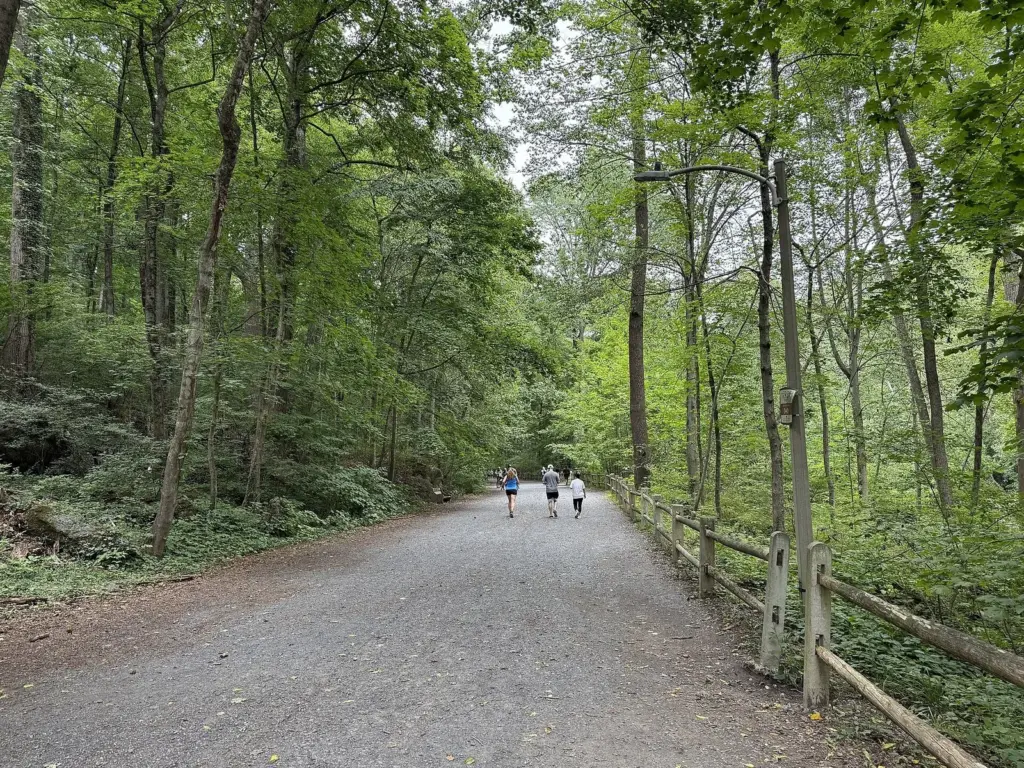
Free; easy on Forbidden Drive, moderate to hard above it; year-round. The best hike in Philadelphia is inside the city limits. Friends of the Wissahickon counts 2,000 acres and more than 50 miles of trails in the gorge, and Forbidden Drive, a wide, flat gravel road closed to cars, runs about five miles along Wissahickon Creek. It’s the easy option, and it’s busy with runners, cyclists and riders on horseback. Climb onto the Orange, White or Yellow trails above it and the crowds thin, the footing turns rocky, and you get the same creek from the cliffs.
Plan it: Northwest Philadelphia, about 25 minutes from Center City by car, with trailheads and parking along the creek. Free. Trail maps are on the Friends of the Wissahickon site. Allow 2 to 4 hours. Best for: a big-woods walk without leaving Philadelphia.
2. Valley Forge: Mount Misery and the Joseph Plumb Martin Trail
Free; easy to moderate; up to 8.7 miles on the paved loop; year-round. The National Park Service counts more than 35 miles of designated trails at Valley Forge. The paved Joseph Plumb Martin Trail, 8.7 miles in all with a 5-mile inner loop, circles the Grand Parade past the encampment’s key sites; it’s hilly and has little shade, so go early in summer. For an actual hike, head for Mount Misery or Mount Joy, where steep wooded trails climb to views, or follow the mostly level Valley Creek Trail.
Plan it: King of Prussia, about 35 minutes from Philadelphia. No entrance fee, and the grounds are open daily from 7am until 30 minutes after sunset (NPS, as of October 2026). Allow 2 to 4 hours. Best for: history with your miles.
3. French Creek State Park
Free; moderate; 35+ miles of trails; spring and fall. DCNR calls French Creek the largest block of contiguous forest between Washington, D.C. and New York City, and the park’s more than 35 miles of well-marked trails let you lose an afternoon in it. It’s the closest thing to the northern forests within an hour of Philadelphia, and on a weekday you may have a whole loop to yourself.
Plan it: Near Elverson, on the Berks and Chester county line, about 1 hour from Philadelphia and 1 hour 15 minutes from Harrisburg. Free entry and parking. Allow a half day. Best for: a long woods loop near the city.
4. Ridley Creek State Park
Free; easy to moderate; 13 miles of trails; year-round. Ridley Creek sits about 16 miles from Center City, and its trails are made for a few hours, not a whole day. The 4.3-mile White Trail loop links most of the others, and the paved 4.3-mile Sycamore Mills Road trail follows the creek for strollers, bikes and anyone who wants flat ground.
Plan it: Delaware County, near Media, about 35 minutes from Philadelphia. Free. Allow about 2 hours. Best for: an after-work or Sunday-morning loop.
5. Delaware Canal Towpath
Free; easiest; 59 flat miles; accessible; year-round. The towpath of the old Delaware Canal runs 59 miles from Easton to Bristol, and DCNR rates all of it easiest and ADA accessible. It’s part of the 165-mile D&L Trail. You won’t get a summit, but you will get the Delaware River on one side, the canal on the other and a river town every few miles for lunch.
Plan it: Access points in the canal towns between Bristol and Easton; New Hope is about 50 minutes from Philadelphia. Free. Mile markers help with pacing. Best for: easy walking with stops.
6. Susquehannock State Park overlooks
Free; short but steep; 5.6 miles of trails; late June for rhododendron. High above the lower Susquehanna in southern Lancaster County, this small park packs its effort into short trails. The 0.75-mile Overlook Trail leads to the Hawk Point and Wisslers Run overlooks of the river, and the 1.3-mile Rhododendron Trail, the park’s longest and roughest, blooms in late June and early July. Don’t confuse its Pinnacle Overlook with The Pinnacle in Berks County; they’re nearly 60 miles apart.
Plan it: 1880 Park Drive, Drumore, about 1 hour 45 minutes from Philadelphia and 1 hour 30 minutes from Harrisburg. Free. Allow 1 to 2 hours. Best for: big-river views on a Lancaster trip.
7. Heritage Rail Trail, York County
Free; easiest; about 21 miles; year-round. York County’s rail trail follows the old Northern Central Railway from the Mason-Dixon line near New Freedom north through Glen Rock, Seven Valleys and the Howard Tunnel to York, on crushed limestone. At the state line it continues into Maryland as the NCR Trail, so you can walk into another state without noticing the border.
Plan it: Trailheads in New Freedom, Glen Rock and York; New Freedom is about 1 hour from Harrisburg and 2 hours from Philadelphia. Free. Best for: a flat out-and-back with small-town stops.
Hawk Mountain and the Appalachian Trail’s eastern ridges
East of the Susquehanna, the Appalachian Trail follows a chain of long ridges, ending on the Kittatinny Ridge (locally Blue Mountain) for its run to the Delaware Water Gap. This is Rocksylvania proper: the ATC says these long, flat ridges are where the state’s rocky reputation comes from. The ATC also notes that the Kittatinny is a Globally Important Bird Area, and much of the trail here crosses state game lands, so read the hunting-season rules before an autumn trip.
8. Hawk Mountain Sanctuary
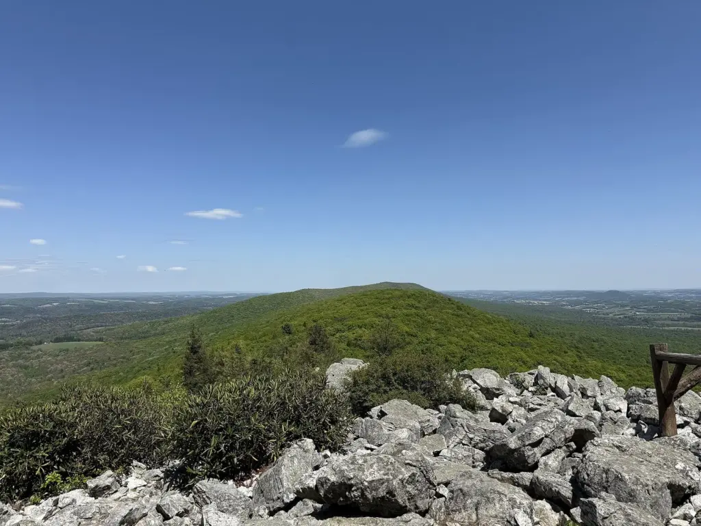
Trail fee; easy to very hard; mid-August to mid-December for hawks. Hawk Mountain is a private nonprofit sanctuary, not a state park, and its trails range from wheelchair-friendly to seriously hard. The groomed walk to South Lookout is just 175 yards from the entrance gate. The Lookout Trail climbs 300 feet to North Lookout, a pile of boulders you scramble across, where the daily Autumn Hawkwatch runs from August 15 to December 15. The River of Rocks loop drops 600 feet into an Ice Age boulder field; the sanctuary says to allow 3 to 4 hours and calls it very rough. The Skyline Trail includes four-point scrambling and a 30-foot vertical descent near North Lookout, so it’s for experienced hikers only.
Plan it: Kempton area, Berks County, about 1 hour 30 minutes from Philadelphia and 1 hour 15 minutes from Harrisburg. Trail fee $10 for adults, $7 for seniors 65 and up, $5 for ages 6 to 12 (as of September 2026); trails are open daily 9am to 5pm except four holidays, and pets aren’t allowed (trail descriptions). Allow 2 to 4 hours. Best for: raptor migration and a real scramble.
9. The Pinnacle and Pulpit Rock
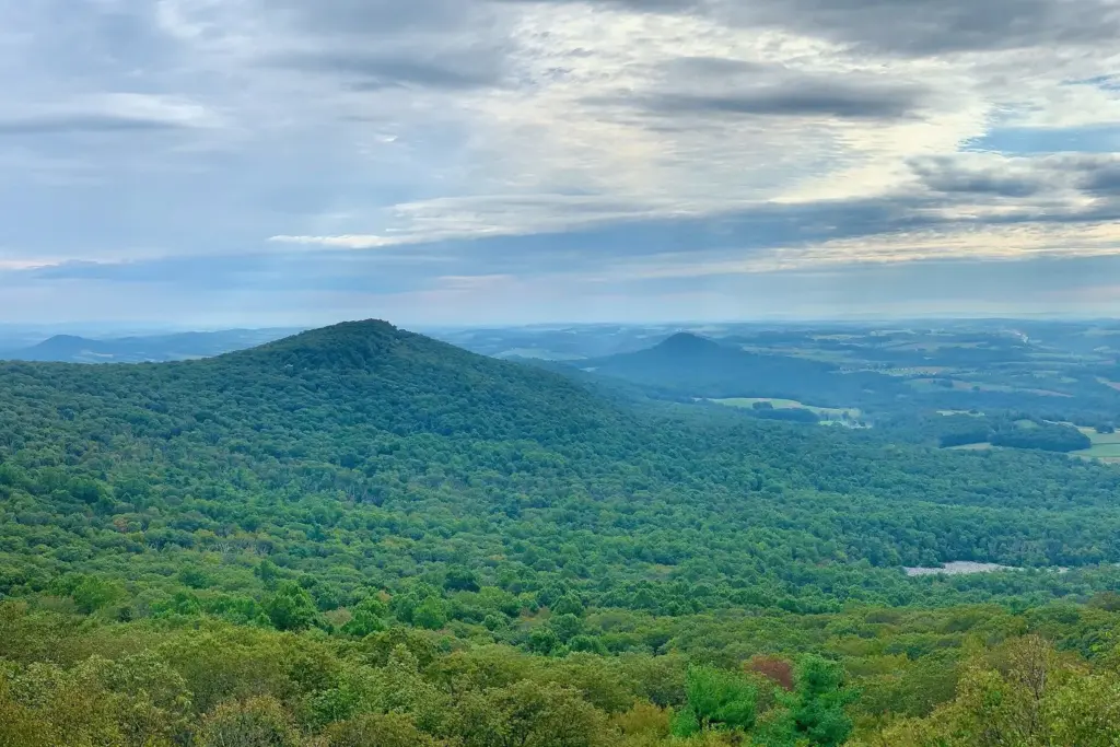
Free; moderate to strenuous; about 8.5 to 9.3 miles; best in fall and on clear winter days. If you hike one stretch of the A.T. in Pennsylvania, make it this one. The usual loop leaves the Hamburg Reservoir lot, climbs the white-blazed A.T. to Pulpit Rock, follows the ridge to The Pinnacle’s cliff-edge view over farm country, and returns on a woods road past the reservoir. Published lengths vary by a mile or so, the ridge section is rocky, and fall weekends are busy, so start early.
Plan it: Hamburg Reservoir lot on Reservoir Road north of Hamburg, about 1 hour 30 minutes from Philadelphia and 1 hour from Harrisburg. Free. Allow 4 to 5 hours. As on most of the A.T. east of the Susquehanna, wear orange from October through January. Best for: the classic Berks County ridge day.
10. Bake Oven Knob
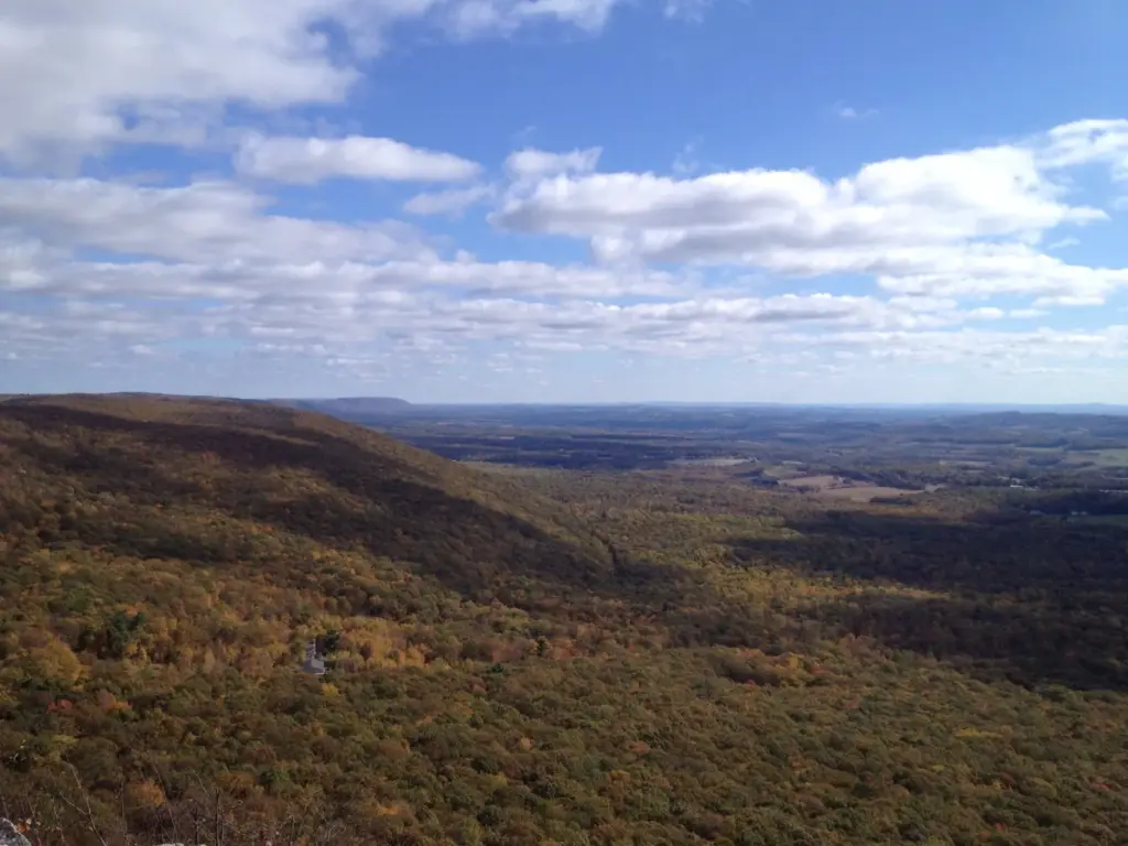
Free; easy; 0.8 mile round trip; October for color and hawks. This is the shortest real summit on our list. From the road, the A.T. reaches the 1,560-foot top of Bake Oven Knob at mile 0.4, and the ATC notes two vantage points, one looking north and one south. The rocks are uneven, so it’s not stroller territory, but most kids can manage it.
Plan it: Parking where the A.T. crosses Bake Oven Road, 1.7 miles south of Germans Road in Andreas; about 1 hour 30 minutes from Philadelphia or Harrisburg. Free. Allow 45 minutes. Best for: a quick ridge view.
11. Weathering Knob at Little Gap
Free; moderate; 2.0 miles round trip. After a boggy start, this ATC day hike climbs steeply over rocks and volunteer-built stone steps to Weathering Knob at 0.3 mile, with a view north over the valley of Aquashicola Creek between Stony and Chestnut ridges. You’ve done nearly all the climbing by then; the rest is an easy ridge walk to a second knob at 1 mile.
Plan it: Game Commission lot on Blue Mountain Road at Little Gap, north of Danielsville, about 1 hour 30 minutes from Philadelphia. Free. Allow 1 to 1.5 hours. Best for: a short, steep taste of Rocksylvania.
12. Wolf Rocks
Free; moderate; 3.2 miles round trip. From Fox Gap, the ATC route heads south on the A.T., passes under a phone line, follows an old woods road for 0.6 mile and reaches the rock outcrop the hike is named for. It’s an easy one to find and a good warm-up before the Water Gap.
Plan it: Small parking area at Fox Gap on PA 191, about 4 miles south of PA 611; about 1 hour 45 minutes from Philadelphia. Free. Allow 1.5 to 2 hours. Best for: an easy A.T. leg near Stroudsburg.
13. Mount Minsi
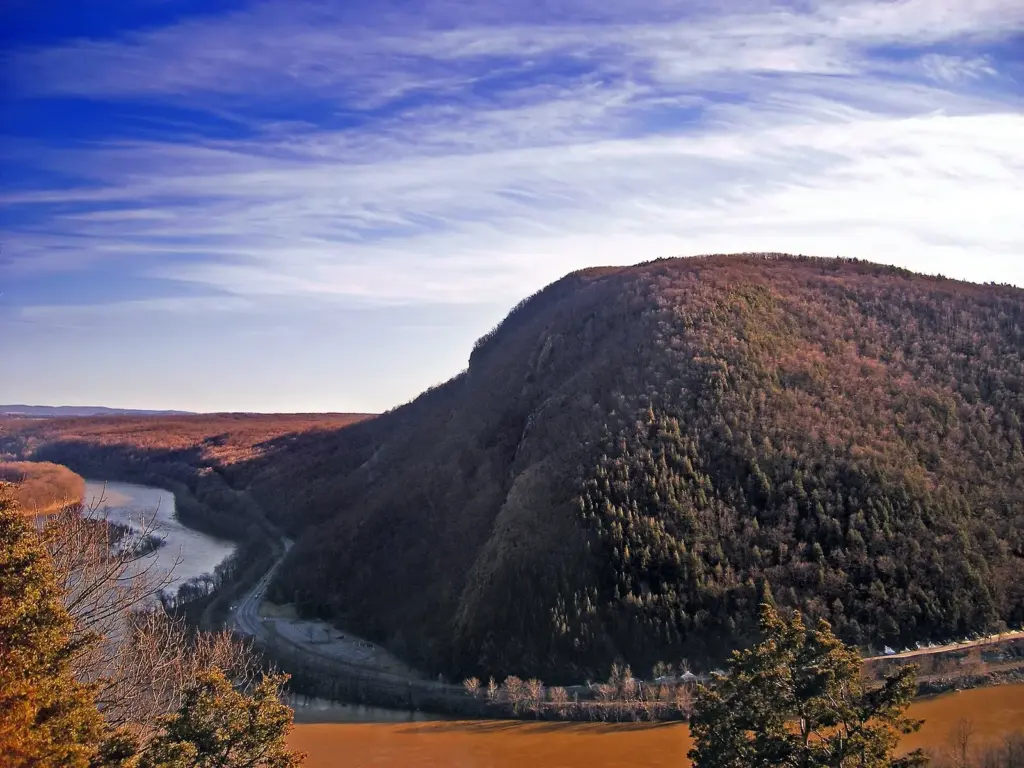
Free; moderate; 1.8 miles each way; best on weekdays. The NPS lists the A.T. from Delaware Water Gap borough to Mount Minsi at 1.8 miles, rated moderate, and the reward is a view down into the gap and across to Mount Tammany in New Jersey. The recreation area holds 28 miles of the A.T., and this short climb from the borough is the obvious one to do, so expect company on a fall Saturday.
Plan it: Lake Lenape lot on Mountain Road in Delaware Water Gap borough, about 2 hours from Philadelphia. Free. Allow 2.5 to 3 hours. Best for: the Water Gap view without crossing the river.
The Poconos and the Lehigh Gorge
The Pocono Plateau is wetter and flatter on top than its name suggests, with bogs, glacial lakes and long state forest loops; the drama is in the gorges cut into its edges. Two famous waterfall hikes are off the table for now: Glen Onoko Falls has been closed since 2019 for a rebuild, and the NPS has closed Dingmans Falls for construction. The open falls, from Bushkill to Hawk Falls, are in our guide to waterfalls in Pennsylvania. Leave early on weekends: traffic on I-476 and I-80 can slow the drive from Philadelphia considerably.
14. Lehigh Gorge Trail
Free; easiest; 26 miles of gravel; spring and fall. The Lehigh Gorge Trail follows the river for 26 miles through Lehigh Gorge State Park and is part of the 165-mile D&L Trail. DCNR points out waterfalls, wildlife and remnants of the old Lehigh Canal along the way. It’s flat enough for anyone, and you share it with bikes. Stay off the closed Glen Onoko trail beside it; the barriers are there for a reason.
Plan it: Access areas between Jim Thorpe and White Haven, Carbon and Luzerne counties; about 2 hours from Philadelphia. Free. Walk an out-and-back of any length. Best for: easy miles at the bottom of a deep gorge.
15. Bald Mountain Loop
Free; moderate; 8.5-mile loop. For a view of the gorge instead of a walk along it, DCNR’s 8.5-mile Bald Mountain Loop Trail climbs to the top of Bald Mountain with several overlooks of the Lehigh Gorge and river. The 0.8-mile Vista Trail loop branches off it for more views.
Plan it: Lehigh Gorge State Park, about 2 hours from Philadelphia and 2 hours 30 minutes from Harrisburg. Free. Allow 4 to 5 hours. Best for: getting above the gorge.
16. Hickory Run: Boulder Field and Shades of Death
Free; moderate to most difficult; 1 to 3.5 miles; spring through fall. Hickory Run has 44 miles of trails, and two of them are classics. The Boulder Field Trail is a 3.5-mile out-and-back to Boulder Field, a National Natural Landmark of bare stone in the middle of the forest. Shades of Death, only a mile long but rated most difficult, follows Sand Spring Run past the remains of logging mills and dams from the early 1800s. Add the 0.6-mile walk to Hawk Falls and you have a full day.
Plan it: Carbon County, off I-80 near White Haven; about 1 hour 45 minutes from Philadelphia or Harrisburg. Free. DCNR warns that trailhead parking can fill early, even on weekdays. Best for: boulders, ruins and a waterfall in one park.
17. Big Pocono State Park
Free; easy loop or a steep 600-foot drop; clear fall days. Big Pocono covers the summit of Camelback Mountain, with views into three states. Because the park is a mountaintop, DCNR says most of its 8.5 miles of trails are steep. The exception is the 1.3-mile Indian Trail loop, the easiest in the park, along the eastern cliffs. The North Trail drops 600 feet in a mile if you want to pay for the view on the way back up.
Plan it: Monroe County, above Tannersville, about 2 hours from Philadelphia. Free. Allow 1 to 3 hours. Best for: a big view for little effort.
18. Bruce Lake, Promised Land
Free; easiest; about 5 miles round trip; spring and fall. About 50 miles of trails run through Promised Land State Park and the Delaware State Forest around it. The best is the easiest: the Bruce Lake Trail follows an old forest road 2.5 miles from its trailhead on PA 390 to Bruce Lake, a natural glacial lake. Back in the park, the 1-mile Little Falls Trail loop passes a string of small waterfalls on the East Branch of Wallenpaupack Creek.
Plan it: Pike County, on the Pocono Plateau at about 1,800 feet, about 2 hours 30 minutes from Philadelphia. Free. Allow 2.5 to 3 hours. Best for: an easy walk to a wild lake.
19. Pinchot Trail
Free; strenuous; 22-mile loop. DCNR’s orange-blazed loop crosses the Pocono Plateau in Pinchot State Forest, past a forest overlook, a hemlock-shaded creek and bogs with plants you don’t often see in Pennsylvania. A fit hiker can do it in one long day, but DCNR says most take two or more, or use the connector trails to make shorter loops.
Plan it: Near Thornhurst, Lackawanna County, about 2 hours from Philadelphia. Free. Check DCNR’s state forest camping rules before an overnight. Best for: a first Pocono backpack.
20. Thunder Swamp Trail
Free; moderate; 45-mile network. The Youth Conservation Corps built this network of interconnecting loops in the 1970s, and DCNR now protects its corridor as a State Forest Hiking Trail. Expect gradual climbs, dry ridgetops, cool wetlands and stream crossings rather than big views. Its loops make it easy to pick a distance.
Plan it: Delaware State Forest near Stroudsburg; get DCNR’s trail map before you go to choose a trailhead and loop. Free. Best for: quiet Pocono woods away from the resorts.
Harrisburg, South Mountain and the central ridges
South of Harrisburg, South Mountain carries the gentlest stretch of the A.T. in the state; the ATC says the southern section, including the Cumberland Valley, has some of the smoothest terrain on the whole trail. North and west of the capital, long ridges and the Juniata country make for steeper, quieter hikes. One rule to know: fires are banned on the A.T. in Michaux State Forest from March 1 to May 25.
21. Pole Steeple
Free; short but rated most difficult; 0.75 mile up; year-round. No hike in the state gives more view per minute. From the Pole Steeple lot across Railroad Bed Road from Laurel Lake, the blue-blazed trail climbs Piney Mountain steeply to a quartzite outcrop that looks over all of Pine Grove Furnace State Park. DCNR warns that the steep grade and sheer drop may stress some people and asks parents to keep children close on the rocks.
Plan it: Pine Grove Furnace State Park, Cumberland County, about 50 minutes from Harrisburg and 2 hours 30 minutes from Philadelphia. Free. Allow 1 to 1.5 hours. Best for: a big view before lunch.
22. The Appalachian Trail midpoint at Pine Grove Furnace
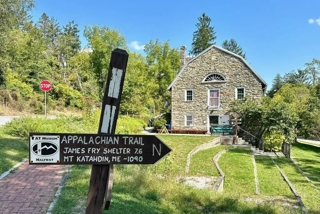
Free; easy; 3.4 miles round trip (or 1.1). Pine Grove Furnace marks roughly the halfway point of the Appalachian Trail, and DCNR says thru-hikers mark it by trying to eat a half-gallon of ice cream. The ATC’s day hike follows the A.T. out of the park to the 2011 Midpoint Sign, a large wooden sign with a trail register; a 1.1-mile version starts from a pull-off on Michaux Road. The Appalachian Trail Museum sits beside the trail in the park, and the park’s 3-mile Hiker Biker Trail is flat and ADA accessible.
Plan it: Furnace Stack Day Use Area lot, marked for A.T. hikers; about 50 minutes from Harrisburg. Free. Register at the visitor center if you’ll park overnight. Allow 2 hours. Best for: families and anyone who wants to say they’ve hiked the A.T.
23. Kings Gap
Free; moderate; 25 miles of rocky trails. Kings Gap Environmental Education Center sits on South Mountain with a stone mansion on top, and DCNR recommends sturdy footwear because most of its trails are rocky. The 2.5-mile Scenic Vista Trail has a vista midway, and the 0.8-mile Ridge Overlook Trail, rated most difficult, adds boulder outcrops and a view of the valley. The 6-mile Buck Ridge Trail links Kings Gap to Pine Grove Furnace for a point-to-point day.
Plan it: Cumberland County, south of Carlisle, about 45 minutes from Harrisburg. Free. Allow 2 to 3 hours. Best for: a quieter day than Pine Grove.
24. Flat Rock, Colonel Denning State Park
Free; rated most difficult; 2.5 miles each way; mid to late October. DCNR’s description is honest: the Flat Rock Trail is steep and rocky, and worth it. It starts in the park and climbs 2.5 miles to the top of Blue Mountain in Tuscarora State Forest, ending at Flat Rock, an outcrop over the Cumberland Valley. In our view it’s the best valley view near Harrisburg.
Plan it: Doubling Gap, Cumberland County, about 1 hour from Harrisburg. Free. Allow 3 to 4 hours. Best for: hikers who don’t mind a climb.
25. Table Rock
Free; easy; 4.2 miles round trip. The ATC rates this one easy. From the parking area on PA 225, the A.T. crosses a powerline at 0.6 mile, where a 2022 relocation opened views over the Susquehanna valley, and at mile 2 a short blue-blazed side trail leads to Table Rock Outlook over Clarks Valley and Stony Mountain. Bring lunch for the rock.
Plan it: A.T. parking area on PA 225, 4.3 miles north of US 22/322 in Dauphin; about 25 minutes from Harrisburg. Free. Allow 2 to 2.5 hours. Best for: the easiest A.T. view near the capital.
26. Thousand Steps
Free; strenuous; under 3 miles round trip; avoid hot afternoons. In the 1930s, quarry workers built a stone stairway up Jacks Mountain to reach their jobs, and hikers now climb it on the Standing Stone Trail, which links the Tuscarora and Mid State trails. Count on roughly a thousand steps, then views over the valley from the old quarry. Trail sources differ on the exact step count; nobody disputes that your legs will feel it.
Plan it: Gravel pull-off on US 22 between Mapleton and Mount Union, Huntingdon County; traffic is fast, so pull in and out carefully. About 1 hour 30 minutes from Harrisburg and 2 hours 45 minutes from Pittsburgh. Free. Allow 2 to 3 hours. Best for: a leg workout with history.
27. Trough Creek State Park
Free; moderate; 12 miles of trails. Great Trough Creek cuts a gorge through Terrace Mountain just before Raystown Lake, and DCNR’s short trails thread it. The Balanced Rock Trail crosses the creek on a suspension bridge, passes Rainbow Falls and climbs CCC-built stone steps to Balanced Rock. For more, DCNR suggests combining the Copperas Rock, Ledges, Abbot Run and Rhododendron trails into a 2.5-mile loop with a panoramic view from the Ledges Trail.
Plan it: Huntingdon County, about 2 hours from Harrisburg and 2 hours 45 minutes from Pittsburgh. Free. Open daily, sunrise to sunset. Allow 2 to 3 hours. Best for: odd geology in a small package.
Pine Creek Gorge, the Endless Mountains and the Pennsylvania Wilds
The northern tier is where Pennsylvania hiking gets wild: long state forest trails, few towns and deep gorges cut through the plateau. Pine Creek Gorge runs about 47 miles and reaches 1,450 feet deep at Waterville, per DCNR. The state’s most famous single hike, the Falls Trail at Ricketts Glen, is covered with the other falls in our guide to Pennsylvania’s waterfalls; it closes in winter to everyone but equipped ice climbers and hikers.
28. Canyon Vista and High Rock, Worlds End
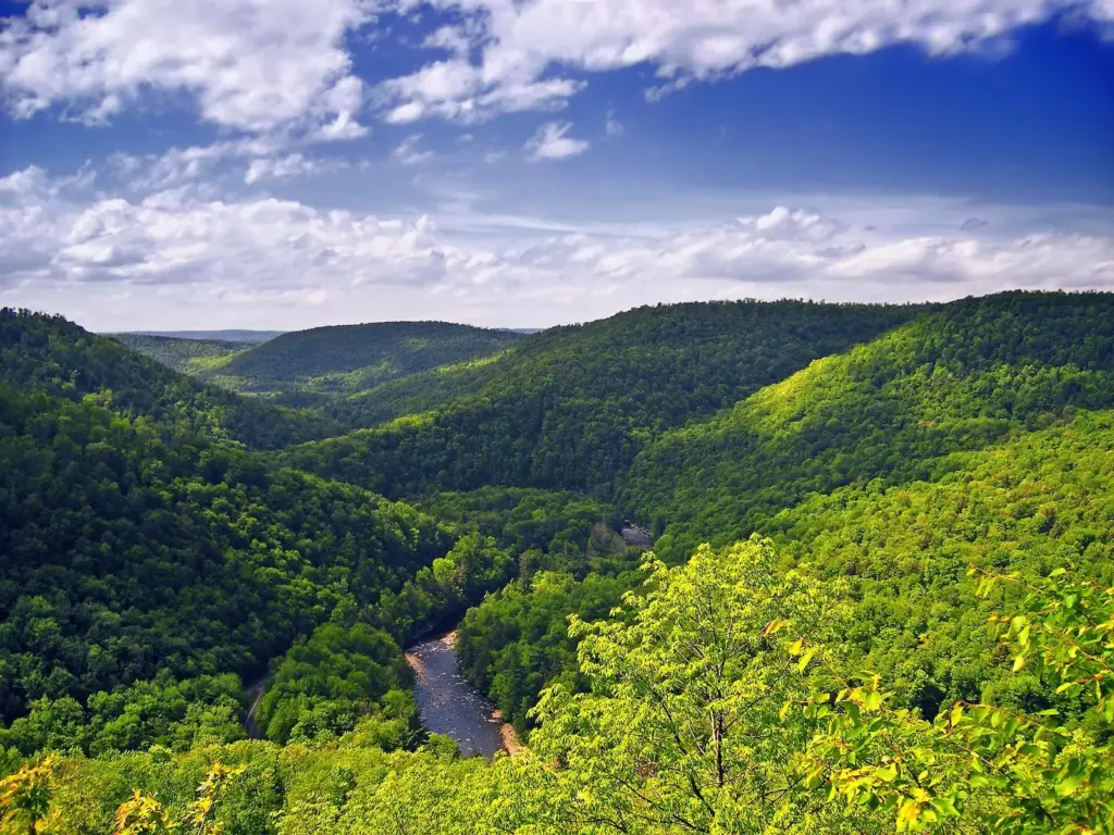
Free; moderate to most difficult; 1 to 4 miles; best in October. DCNR says Worlds End’s 20-plus miles of trails are mostly rocky, with steep climbs, and two short ones earn their reputation. The 4.0-mile Canyon Vista Trail loop reaches the Loyalsock Creek Gorge vista at 1,750 feet, next to the Rock Garden’s blocky maze of boulders. The 1-mile High Rock Trail, rated most difficult, climbs several hundred feet through lichen-covered rocks to High Rock Vista. If knees won’t allow either, you can drive to Canyon Vista. In early October it’s one of the best places for fall color in Pennsylvania, so arrive early.
Plan it: 82 Cabin Bridge Road, Forksville, Sullivan County, about 2 hours 30 minutes from Harrisburg and 3 hours 30 minutes from Philadelphia. Free. Allow 2 to 3 hours. Best for: the best short loop in the Endless Mountains.
29. Loyalsock Trail
Free; more difficult; 59 miles point to point. The rugged Loyalsock Trail follows the ridges and streams of the Loyalsock watershed for 59.21 miles, from PA 87 near Loyalsockville to US 220 north of Laporte, marked with a yellow disc and a red LT. It runs through Worlds End, which makes the park the easiest place to try a section before you commit to the whole thing.
Plan it: End trailheads on PA 87 near Loyalsockville and US 220 north of Laporte, with access in Worlds End State Park. Free. Plan on several days for the full trail. Best for: section hikers and backpackers.
30. Turkey Path, Pine Creek Gorge
Free; most difficult; 1 mile down about 800 feet, then back up. From Leonard Harrison State Park on the east rim, the Turkey Path drops about 800 feet in a mile past waterfalls to the canyon floor, where it meets the Pine Creek Rail Trail. The hike down is the easy half. On the west rim, Colton Point’s own Turkey Path descends 1.5 miles, with a 70-foot cascade less than half a mile down, and its 1-mile Rim Trail gives you the vistas without the climb. Leonard Harrison’s 0.6-mile Overlook Trail is the gentle option on the east side.
Plan it: Leonard Harrison State Park, 4797 Route 660, 10 miles west of Wellsboro; about 3 hours from Harrisburg and 4 hours 30 minutes from Philadelphia. Open daily, sunrise to sunset. Free. Restrooms and water at the trailhead. Allow 1.5 to 2 hours. Best for: the canyon floor on your own legs.
31. West Rim Trail
Free; moderate; 30 miles point to point; May to October. DCNR’s West Rim Trail runs 30 miles along the western rim of Pine Creek Gorge. In the north, the canyon is about 800 feet deep and 2,000 feet from rim to rim, and the trail keeps returning to its edge. It’s the classic Pennsylvania backpack; plan on two or three days.
Plan it: Northern trailhead near Ansonia, off US 6 in Tioga County, about 3 hours 15 minutes from Harrisburg and 4 hours 30 minutes from Philadelphia. Free. Arrange a shuttle or a second car for the far end. Best for: a first multi-day trip with big views.
32. Pine Creek Rail Trail
Free; easiest; 62 miles; spring and fall. The canyon with none of the climbing. The 62-mile rail trail runs from Jersey Shore to Wellsboro Junction and follows Pine Creek for 55 of those miles. DCNR named it Pennsylvania’s 2026 Trail of the Year, and the 3.2-mile Marsh Creek Greenway now links its northern end to downtown Wellsboro.
Plan it: Wellsboro Junction at the north end, Jersey Shore at the south, with access in creekside villages such as Slate Run; Wellsboro is about 2 hours 45 minutes from Harrisburg. Free. Best for: walkers who want the gorge flat.
33. Golden Eagle Trail
Free; strenuous; 8.9-mile loop; no camping. DCNR rates this loop strenuous, and the climbs out of the Pine Creek valley explain why. The orange-blazed trail starts about four miles north of Cammal at the mouth of Bonnell Run and rewards you with vistas over the gorge. Because the terrain is so rugged, overnight camping isn’t allowed along it, so it’s a day hike, and a long one.
Plan it: PA 414 north of Cammal, Lycoming County, about 2 hours 45 minutes from Harrisburg. Free. Allow a full day. Best for: strong day hikers.
34. Black Forest Trail
Free; moderate to strenuous; 42.1-mile loop. Named for the dark conifer forests that once covered the region, this loop near Slate Run is a serious undertaking. DCNR warns of many steep climbs and promises that the vistas over Slate Run, Morris Run, Big Dam Hollow, Naval Run and Pine Creek are worth them. In spring, high water makes the creek crossings beautiful and harder.
Plan it: Starts 0.8 mile from Slate Run village on a state forest road off PA 414, Lycoming County; about 2 hours 45 minutes from Harrisburg. Free. Best for: experienced backpackers.
35. Old Loggers Path
Free; easy to moderate; 27-mile loop. If the Black Forest Trail sounds like too much, this Loyalsock State Forest loop near Masten is DCNR’s gentler alternative. A section near Short Run was rerouted after the October 2016 flood to avoid a steep, eroding climb, which makes it easier still.
Plan it: Masten, Lycoming County, about 2 hours 30 minutes from Harrisburg. Free. Best for: a first two- or three-night loop.
36. Susquehannock Trail System
Free; easy to strenuous; 85-mile loop. This long oval through Susquehannock State Forest visits Ole Bull and Patterson state parks, the Hammersley Wild Area and the fire tower at Cherry Springs, on a mix of footpaths, logging roads and old railroad grades. DCNR suggests at least a week for the full loop. Long, even ridges and brook-trout runs make it more about solitude than summits.
Plan it: Near Coudersport, Potter County; Ole Bull State Park is about 3 hours 15 minutes from Harrisburg. Free. Best for: a week of real quiet.
37. Quehanna Trail
Free; strenuous; 75-mile loop; a bridge is out. The Quehanna Trail loops from Parker Dam State Park through the Quehanna Wild Area in Moshannon and Elk state forests, and cross-connectors and side trails add about 30 more miles. DCNR lists the Mosquito Creek Bridge as temporarily closed for flood damage, so check the notice before you plan a full loop.
Plan it: Parker Dam State Park, Penfield, Clearfield County, about 2 hours 30 minutes from Pittsburgh and 2 hours 45 minutes from Harrisburg. Free. Best for: the wildest big loop in the state.
The Laurel Highlands and southwestern Pennsylvania
Laurel Ridge runs from the Youghiogheny River at Ohiopyle to the Conemaugh Gorge near Johnstown, and DCNR notes it’s cooler and wetter than the valleys around it, so pack a layer. Ohiopyle State Park alone has 79 miles of trails.
38. Ferncliff Trail, Ohiopyle
Free; moderate; 1.7-mile loop; year-round. The best short hike in the southwest circles the Ferncliff peninsula at the river’s edge, past Ohiopyle Falls, Washington’s Overlook and Lovers Leap, through old-growth hemlock, white pine and giant oaks. In spring, add the easy 1.3-mile Great Gorge Trail, which follows an old tramway and has the park’s best wildflowers.
Plan it: Ohiopyle borough, Fayette County, about 1 hour 45 minutes from Pittsburgh and 3 hours 30 minutes from Harrisburg. Free. Allow 1 to 1.5 hours. Best for: a first look at Ohiopyle.
39. Baughman Trail
Free; most difficult; 3.4 miles. DCNR calls this trail steep and rocky. It climbs from across the Great Allegheny Passage near the Middle Yough boater take-out to Baughman Rock Overlook, where DCNR says you can look into the deepest gorge in Pennsylvania. You can also drive to the overlook and hike only the upper half.
Plan it: Ohiopyle State Park, about 1 hour 45 minutes from Pittsburgh. Free. Allow 2 to 3 hours. Best for: earning the Youghiogheny view.
40. Laurel Highlands Hiking Trail
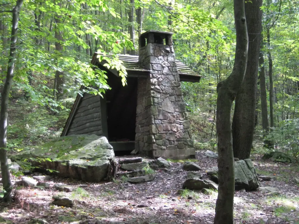
Free; most difficult; 70 miles; day sections year-round. The yellow-blazed Laurel Highlands Hiking Trail runs 70 miles from Ohiopyle to the Conemaugh Gorge near Johnstown and is part of the Potomac Heritage National Scenic Trail. DCNR has made it easy to do in pieces: six trailheads have parking for 30 cars each, mileage monuments mark every mile, and dogs are allowed. Non-potable water is available at most trailheads and shelter areas, so carry a filter. DCNR suggests planning on 1.5 miles an hour, which is slower than most people expect and about right for the terrain.
Plan it: Southern terminus in Ohiopyle, about 1 hour 45 minutes from Pittsburgh. Free to hike; check DCNR’s Laurel Ridge page for overnight rules at the shelter areas. Best for: the best-organized long trail in Pennsylvania.
41. Great Allegheny Passage
Free; easiest; 150 miles; year-round. The Great Allegheny Passage runs 150 miles from Pittsburgh to Cumberland, Maryland, crossing the Eastern Continental Divide and passing trail towns such as Homestead, West Newton, Connellsville, Ohiopyle and Confluence. It’s mostly a cycling route, but the stretch around Ohiopyle, with the high bridge over the Youghiogheny, is a fine flat walk.
Plan it: Trail towns from Homestead to Confluence; Ohiopyle is about 1 hour 45 minutes from Pittsburgh. Free. Keep right for bikes. Best for: flat river miles.
42. Mount Davis
Free; easy; the state’s highest point. Pennsylvania’s high point is a gentle one. The High Point Observation Tower on Mount Davis stands at 3,213 feet, and the High Point Trail is one of more than 100 trails in Forbes State Forest, which has more than 250 miles of trails and roads you can hike. Pair it with Wolf Rocks or Beam Rocks, other Forbes vistas, for a fuller day.
Plan it: Forbes State Forest, Somerset County, about 1 hour 45 minutes from Pittsburgh and 3 hours from Harrisburg. Free. Allow about an hour for the tower and a short walk. Best for: high-point collectors.
43. Ghost Town Trail
Free; easiest; about 46 miles; spring through fall. This rail trail crosses the old coal country of Indiana and Cambria counties, from Black Lick east past Dilltown and Vintondale, where it splits into a loop through Nanty Glo, and on to Ebensburg. Published lengths vary by a mile or two depending on how the loop is counted.
Plan it: Trailheads include Dilltown, Vintondale, Nanty Glo and Ebensburg; Dilltown is about 1 hour 15 minutes from Pittsburgh. Free. Best for: easy miles with industrial history.
Pittsburgh and northwestern Pennsylvania
Pittsburgh’s hills are steep enough to train on, and within two hours you can reach glacial gorges, an old-growth forest and the valley where the oil industry began.
44. Kildoo Trail, McConnells Mill
Free; moderate to difficult; 3.0-mile loop; spring and fall. McConnells Mill protects Slippery Rock Creek Gorge, a National Natural Landmark carved by draining glacial lakes, with a gristmill and covered bridge from the 1800s. The Kildoo Trail loops 3 miles from either end of the covered bridge; its eastern bank is easier and leads to Kildoo Falls, while the rest scrambles through the boulders. The flat, half-mile Hells Hollow Trail is the family option.
Plan it: Lawrence County, about 45 minutes north of Pittsburgh. Free. Rocks near the creek are slick; stay out of the water. Allow 2 hours. Best for: the closest real gorge to Pittsburgh.
45. Glacier Ridge Trail, Moraine State Park
Free; most difficult in the park, or easy loops; 14.8 miles. Moraine’s 29 miles of trails circle Lake Arthur. The blue-blazed Glacier Ridge Trail runs 14.8 miles through the park to Jennings Environmental Education Center as part of the North Country National Scenic Trail. For something gentler, the Sunken Garden Trail offers easy 1.9-, 2.4- and 3.6-mile loops near the park office.
Plan it: Butler County, about 1 hour from Pittsburgh. Free. Best for: a long day on the North Country Trail, or a short lakeside loop.
46. Raccoon Creek State Park
Free; easy to most difficult; spring for wildflowers. Raccoon Creek’s Wildflower Reserve has more than 700 plant species along 4.5 miles of trails, which makes it the place to be on a spring weekend. For distance, the park’s 9.5-mile Heritage Trail passes old homesteads and the Frankfort Mineral Springs, and the 6.2-mile Forest Trail has ridge views of the lake and strong fall color.
Plan it: Beaver County, about 40 minutes west of Pittsburgh. Free. Best for: spring wildflowers.
47. Rachel Carson Trail
Free; varied; 46.2 miles. Named for the Springdale-born author of Silent Spring, this trail runs 46.2 miles north and east of Pittsburgh between Harrison Hills County Park and North Park. Its conservancy calls it extremely varied, and it is: county parks, power and gas line corridors, farmland and the edges of suburbs. Most people hike it in sections.
Plan it: North Park is about 25 minutes from downtown Pittsburgh. Free. Maps and the conservancy’s event calendar are on the Rachel Carson Trails Conservancy site. Best for: Pittsburgh hikers training for something bigger.
48. Montour Trail
Free; easiest; about 63 miles with branches; year-round. The Montour Trail curves around Pittsburgh’s western and southern suburbs from Coraopolis on the Ohio River to Clairton on the Monongahela, mostly on crushed limestone, with a branch toward Pittsburgh International Airport. If you’ve got a long layover and a car, it’s the nearest flat trail to the terminal.
Plan it: Coraopolis trailhead, about 20 minutes from downtown Pittsburgh. Free. Best for: an easy walk-and-bike day close to the city.
49. Longfellow Trail, Cook Forest
Free; moderate; 1.2 miles; year-round. Cook Forest has more than 47 miles of hiking trails, and the best known is the shortest worth doing. The Longfellow Trail runs from the Log Cabin Educational Center through what DCNR calls the finest stand of old-growth white pine in the northeastern United States, part of the Forest Cathedral, a National Natural Landmark. Afterward, climb Fire Tower #9 off Fire Tower Road for a 15- to 20-mile view on a clear day.
Plan it: Cooksburg, Clarion County, about 2 hours from Pittsburgh. Free. Allow 1 to 2 hours. Best for: walking among very old trees.
50. Gerard Hiking Trail, Oil Creek State Park
Free; moderate; 36-mile loop, or 9.7 paved miles. Oil Creek State Park has 52 miles of trails in the valley where the American oil industry began. The yellow-blazed Gerard Hiking Trail loops 36 miles past vistas, waterfalls and historic sites, and five white-blazed connector loops cut it into day hikes. The paved 9.7-mile bike trail along the creek, from Petroleum Centre to Jersey Bridge near the Drake Well Museum, is the flat alternative.
Plan it: Venango County, about 2 hours from Pittsburgh. Free. Best for: oil-boom history on foot.
Long-distance trails and backpacking
Pennsylvania’s long trails are its quiet strength. DCNR’s Bureau of Forestry runs 18 State Forest Hiking Trails, and three National Scenic Trails cross the state. These are the main ones, with DCNR’s lengths and difficulty ratings.
| Trail | Length | DCNR rating | Where |
|---|---|---|---|
| Appalachian Trail | About 230 miles in PA | Easy to strenuous | Pen Mar (Franklin County) to Delaware Water Gap |
| Mid State Trail | 319 miles | Easy to strenuous | New York line to Maryland line |
| Baker Trail | 141 miles | Moderate to strenuous | Freeport to the Allegheny National Forest |
| Tuscarora Trail | 110 miles in PA | Moderate | Deans Gap (A.T.) southwest to Maryland |
| Donut Hole Trail | 90 miles | Moderate to strenuous | Near Jericho to Farrandsville |
| Susquehannock Trail System | 85-mile loop | Easy to strenuous | Near Coudersport |
| Quehanna Trail | 75-mile loop | Strenuous | Parker Dam State Park |
| Laurel Highlands Hiking Trail | 70 miles | Most difficult | Ohiopyle to near Johnstown |
| Loyalsock Trail | 59 miles | More difficult | Near Loyalsockville to north of Laporte |
| Chuck Keiper Trail | 52.8 miles in two loops | Strenuous | Near Renovo |
| Thunder Swamp Trail | 45-mile network | Moderate | Near Stroudsburg |
| Black Forest Trail | 42.1-mile loop | Moderate to strenuous | Slate Run |
| West Rim Trail | 30 miles | Moderate | North end near Ansonia |
| Old Loggers Path | 27-mile loop | Easy to moderate | Masten |
| Pinchot Trail | 22-mile loop | Strenuous | Thornhurst |
A few things that surprise first-time Pennsylvania backpackers. The Appalachian Trail through the state has 26 shelters, per the ATC, but camping rules change from one land manager to the next, so check each section. The Golden Eagle Trail bans overnight camping outright. And DCNR recognizes hikers who finish all of its State Forest Hiking Trails, if you need a project. If you’d rather end the day in a cabin or a campground than a shelter, our guide to the best state parks in Pennsylvania covers where to stay near the trails.
Hiking in Pennsylvania safely: rocks, ticks, bears and hunting season
Rocks, footwear and phones
Take the Rocksylvania nickname seriously. On the Kittatinny Ridge and at places like Hawk Mountain, Pole Steeple and Hickory Run, trails cross boulder fields and ledges, and wet rock is slick. Wear boots or trail shoes with real grip. DCNR’s standing advice applies on even the shortest hike: carry water and a paper map and wear proper footwear, because cell phones are unreliable in the forest and aren’t a substitute for a map.
Ticks
Ticks are the real wildlife risk. The Pennsylvania Department of Health says that, using CDC’s estimate that actual Lyme cases run about ten times the reported number, the state may see around 100,000 cases a year, roughly one for every 100 residents. Use repellent, treat clothing with permethrin, stay in the middle of the trail, and check yourself, your kids and your dog after every hike, including in the shoulder seasons.
Bears, snakes and dogs
Black bears live in forests across most of the state. They usually avoid people, so talk or make noise where you can’t see far ahead, never feed one, and give any bear you meet plenty of room. On sunny summer ledges, watch where you put your hands, because rocky ridges are snake country. Dogs are allowed on the Laurel Highlands Hiking Trail, but Hawk Mountain doesn’t allow pets, so check each place’s rules before you bring one.
Hiking during hunting season
Pennsylvania is a big hunting state, and much of its best hiking is on land open to hunters. Two changes matter for 2026-27. The Game Commission now allows hunting on every Sunday within season dates (except for migratory birds), so Sunday is no longer the safe day it used to be. And the orange rule for non-hunters on state game lands now runs much longer than the old November-to-December window. Archery deer season runs October 3 to November 20, 2026, and again from December 26, 2026 to January 24, 2027; the regular firearms deer season falls between them, and those are the busiest weeks in the woods.
| Where you’re hiking | Hunting | What to do |
|---|---|---|
| State game lands (including much of the A.T. east of the Susquehanna) | Allowed, including Sundays in season | Required from October 1, 2026 to January 30, 2027: a fluorescent orange hat or 250 square inches of orange on head, chest and back |
| State forests | Allowed, including Sundays in season | Wear orange anyway, especially during the firearms seasons |
| State parks | Allowed in most parks during seasons; Sunday hunting limited in some | Check the park’s hunting map; stay on trails; wear orange |
| Private sanctuaries and city parks (Hawk Mountain, the Wissahickon) | Set by the owner | Check the site’s own rules |
Rule details are on the Game Commission’s 2026 season announcement.
Closures to know
- Glen Onoko Falls Trail (Lehigh Gorge) has been closed since 2019 and stays off-limits through 2026 while DCNR rebuilds it; no reopening date has been set.
- Dingmans Falls (Delaware Water Gap) is closed to everyone, including pedestrians, for bridge replacement and trail work, with no reopening date given.
- Quehanna Trail: the Mosquito Creek Bridge was temporarily closed for flood damage as of October 1, 2026.
- Ricketts Glen’s Falls Trail closes in winter to everyone but equipped ice climbers and hikers.
When to go hiking in Pennsylvania
Spring (April and May): creeks run high, waterfalls are at their best and the wildflowers come out, with Ohiopyle’s Great Gorge Trail and Raccoon Creek’s Wildflower Reserve leading the way. Expect mud and wet crossings on the northern backpacking trails.
Early summer: mountain laurel and rhododendron bloom on the ridges; at Susquehannock State Park, DCNR times the rhododendron to late June and early July. Start early to beat the heat, and head for high ground such as Laurel Ridge, which runs cooler than the valleys.
Fall: the best season, full stop. DCNR’s usual peak windows are October 1 to 10 in the northern counties, October 10 to 20 in the center and October 20 to 31 in the south and southeast, and the hawk migration over the Kittatinny Ridge runs from mid-August to mid-December. Our guide on where to see fall foliage in Pennsylvania tracks the color. Remember the orange rule from October 1.
Winter: rail trails such as the Pine Creek, Lehigh Gorge and Great Allegheny Passage stay walkable in dry spells, and leafless ridges give the widest views of the year. Microspikes help on icy north-facing trails, and hunting seasons continue into January.
Hiking in Pennsylvania FAQ
Is Pennsylvania good for hiking?
Yes, and better than its reputation. Pennsylvania has about 230 miles of the Appalachian Trail, 18 State Forest Hiking Trails, and more than 1,750 miles of formal trails in its state parks alone, per DCNR. The best of it is on rocky ridges like the Kittatinny and in gorges like Pine Creek, Loyalsock and Ohiopyle.
How long is the Appalachian Trail in Pennsylvania?
The Appalachian Trail Conservancy lists 230 miles in Pennsylvania, with 26 shelters. It enters near Pen Mar in Franklin County, crosses the Susquehanna north of Harrisburg and leaves at the Delaware Water Gap. Pine Grove Furnace State Park marks roughly the trail’s halfway point.
Where is the best mountain hiking in Pennsylvania?
For views, the Kittatinny Ridge in Berks, Lehigh and Monroe counties (The Pinnacle, Hawk Mountain, Mount Minsi) and the rims of Pine Creek Gorge are hard to beat. For a true mountain feel, try the Laurel Highlands Hiking Trail or the Black Forest Trail. Mount Davis, the state’s high point, is only 3,213 feet.
Can you hike on Pennsylvania state game lands?
Yes. State game lands are open to hikers, and much of the Appalachian Trail east of the Susquehanna crosses them. They’re managed for hunting, though, so from October 1, 2026 to January 30, 2027, non-hunters must wear a fluorescent orange hat or 250 square inches of orange on the head, chest and back.
Do you need to wear orange when hiking in Pennsylvania?
On state game lands, yes, from October 1, 2026 to January 30, 2027, according to the Game Commission. Elsewhere it isn’t required of hikers, but it’s smart anywhere hunting is allowed, which includes state forests and most state parks. Since 2026-27, hunting is allowed on every Sunday in season.
What is the hardest hike in Pennsylvania?
Among day hikes, DCNR’s strenuous Golden Eagle Trail and the Turkey Path round trip are among the toughest, and Hawk Mountain’s Skyline Trail requires four-point scrambling. For multi-day trips, DCNR rates the Quehanna, Chuck Keiper and Pinchot trails strenuous and the Laurel Highlands Hiking Trail most difficult.
When is the best time to go hiking in Pennsylvania?
October is the best month: cool air, fall color and the hawk migration. Late spring is a close second for waterfalls and wildflowers. Summer works if you start early and choose shade or high ground. In winter, stick to rail trails and low ridges, and wear orange where hunting is allowed.
Related Pennsylvania Guides
- The best state parks in Pennsylvania: where to camp, rent a cabin or base a hiking weekend.
- The 40 best waterfalls in Pennsylvania: Ricketts Glen’s Falls Trail, Bushkill, Raymondskill and the western falls.
- Pennsylvania fall foliage: peak dates, scenic drives and the best leaf-peeping hikes.
Sources and How We Checked
Everything on this page was checked on October 1, 2026 against the official sources below and compiled from them; we don’t claim first-hand visits. Drive times are free-flow estimates from OpenStreetMap-based routing (the Valhalla engine), rounded to the nearest 15 minutes, to the trailhead or the park’s main entrance.
- DCNR, State Forest Hiking Trails and National Scenic Trails in Pennsylvania: long-trail lengths, ratings and trailheads.
- DCNR’s state park hiking pages for Pine Grove Furnace, Kings Gap, Colonel Denning, Trough Creek, Worlds End, Leonard Harrison, Colton Point, Lehigh Gorge, Hickory Run, Big Pocono, Promised Land, Ohiopyle, Laurel Ridge, Moraine, Raccoon Creek, Oil Creek, Cook Forest, Ridley Creek, French Creek, Susquehannock and Delaware Canal.
- Appalachian Trail Conservancy, Pennsylvania and its day-hike pages for Table Rock, Bake Oven Knob, Weathering Knob, Wolf Rocks and the 2011 Midpoint Sign.
- Pennsylvania Game Commission, 2026 season announcement, plus DCNR’s hunting page: orange rules, Sunday hunting and season dates.
- NPS, Valley Forge trails and Delaware Water Gap, Appalachian Trail.
- Hawk Mountain Sanctuary, trail descriptions, plus its admission page.
- Friends of the Wissahickon, the Rachel Carson Trails Conservancy and the Pennsylvania Department of Health’s Lyme disease page.
Lengths for the Montour, Ghost Town and Heritage rail trails, the Thousand Steps and The Pinnacle loop are approximate, so check the county or trail group’s page before you go.
Pennsylvania Tourism Guide is an independent publication. We are not affiliated with DCNR, the Pennsylvania Game Commission, the National Park Service, the Appalachian Trail Conservancy, Hawk Mountain Sanctuary, Friends of the Wissahickon, the Rachel Carson Trails Conservancy or any trail club named here, and no one paid to be included.
Photo Credits
- Pine Creek Gorge from the West Rim Trail: photo by Nicholas from Pennsylvania, USA, via Wikimedia Commons (CC BY 2.0)
- Forbidden Drive, Wissahickon Valley Park: photo by Dough4872, via Wikimedia Commons (CC BY-SA 4.0)
- North Lookout, Hawk Mountain Sanctuary: photo by Dough4872, via Wikimedia Commons (CC BY-SA 4.0)
- View from Pulpit Rock, Appalachian Trail: photo by Zeete, via Wikimedia Commons (CC BY-SA 4.0)
- View from Bake Oven Knob: photo by Weston Brophy, via Wikimedia Commons (CC BY 2.0)
- Mount Minsi from Mount Tammany: photo by Nicholas, via Wikimedia Commons (CC BY 2.0)
- Appalachian Trail and Museum, Pine Grove Furnace State Park: photo by Zeete, via Wikimedia Commons (CC BY-SA 4.0)
- Canyon Vista, Worlds End State Park: photo by Nicholas, via Wikimedia Commons (CC BY 2.0)
- Laurel Highlands Hiking Trail: photo by Ron Shawley, via Wikimedia Commons (CC BY 3.0)